The highest point of the range is Mount Te Aroha (952 m), at the foot of which is the town of Te Aroha. The range’s terrain is rough, and only two roads pass over it: State Highway 2, across the northern end of the range through Karangahake Gorge, and State Highway 29 from Tauranga to Hamilton. Mt Te Aroha can be described as the northern head peak of the Kaimai Range.
The Kaimai Ranges feature in local Maori folklore. The name Te Aroha translates from Maori as Te – The & Aroha – Love. Literally “the love”. The name comes from a Maori legend that the sun god – Male, loved the moon goddess – female. They never could see each another due to the planets positions. One day the moon goddess came to earth to see the sun god, knowing the risks, was turned to stone as the daylight came. Hers was the ultimate expression of love. Te Aroha in Maori. This is why on the Kaimai Range, to the right of Mt Te Aroha is a high skyline silhouetted rock that from afar is shaped as a woman. It is known locally as the rock of Hinemoa.
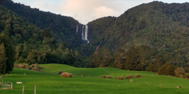
Within the Kaimai Ranges the Hendersons Tramline loop track follows the route of bush tramlines and haul lines once used to extract logs from the bush. The walk includes forest and clearings near the fringe of the park. A side track off the main walk leads down to the base of a waterfall and a large swimming hole. Also some 7 – 10 miles, on the Gordon backroad from te Aroha is a four-wheel drive track named Thomsons track, that takes venturers from the foothills around manawaru to the ranges top, where a large swimming hole is present.
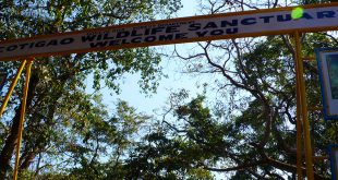
User reviewed online profile of Kaimai-Mamaku Forest Park: Bay of Plenty Region, New Zealand. Plan your adventure holiday to Kaimai-Mamaku Forest Park armed with information and reviews provided by experts and by users. Find out about when to go, how to get there, what to do, best season to visit, its wildlife, habitat and much more…
What to do in Kaimai-Mamaku Forest Park:
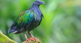
Wild Life: Fantail, North Island Robin, Kereru (Native Pigeon), Waxeye or Silvereye, Tui and Tomtit
Adventure: Rock Climbing, Fishing, Hunting, Trail Bike Riding, Gemstone Collecting
Where is Kaimai-Mamaku Forest Park:
Region:
Location: Tauranga district, Bay of Plenty region, New Zealand
When & how to get to Kaimai-Mamaku Forest Park:
Best Time to Visit: to
Getting There: The Park can be accessed at various points along SH2 (between Tauranga and Katikati), SH 26 (10 kilometres south of Te Aroha) or SH 29 (20 kilometres from Tauranga).
Nearest Town: Tauranga
Nearest Airport:
Nearest Railway Station:
Where to stay (Lodges / Guest Houses / Camps / Resorts / Hotels):
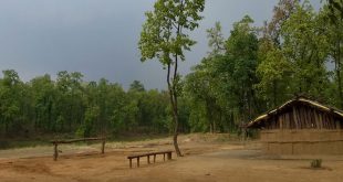
Accommodation: There are numerous camping areas and accommodation huts, which have open fires for cooking and bunks with mattresses. Dry firewood can be scarce, so gas cookers should be carried. A small fee is charged for using the huts.
Add a hotel: If you know of a hotel, resort, guest house or camp please add it here. If you own or manage a hotel or resort you can add it to the database for ‘Free’.
Climate & Weather conditions in Kaimai-Mamaku Forest Park:
Temp: c to c
Rainfall: cm
Altitude: 800 m
Other details about Kaimai-Mamaku Forest Park:
Established: 1975
Area: 370 sq km
Language: English and Maori