The Ruahines run northeast-southwest for 110 kilometres from inland Hawke’s Bay to near Woodville. It is separated in the south from the northern end of the Tararua Range by the Manawatu Gorge.
The highest point in the Ruahines is Mangaweka, situated along the Hikurangi Range, which at 1733 metres (5686 feet) is the second highest non-volcanic mountainous peak in the North Island after Mt Hikurangi (1754 metres/5755 feet) in the Raukumara Range.
The other notable peak is Whariti (920 metres/3017 feet), which visually marks the southern end-point of the Ruahine Range. The dominant geographical landmark in the Manawatu and Southern Hawkes Bay districts, Whariti is perhaps better known in the region for its highly visible television transmission tower, which for a number of decades has rebroadcast national television services to the region.
User reviewed online profile of Ruahine Forest Park: Manawatu-Wanganui region, New Zealand. Plan your adventure holiday to Ruahine Forest Park armed with information and reviews provided by experts and by users. Find out about when to go, how to get there, what to do, best season to visit, its wildlife, habitat and much more…
What to do in Ruahine Forest Park:
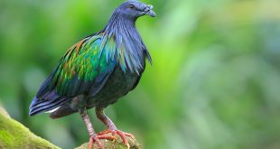
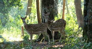
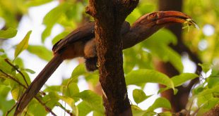
Wild Life: North Island Kaka, Kereru and Whio (Rare Blue Duck)
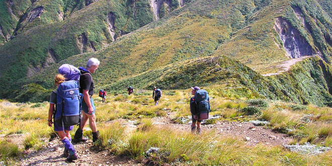
Adventure: Snow Skiing, Rafting, Canoeing, Fishing, Hunting, Tramping, Mountain Biking, Bushwalking, Picnicking, Walking, Four Wheel Driving
Where is Ruahine Forest Park:
Region: Lies south-west of Napier, running from the steep gorges of the Ngaruroro River, 100 km down a straight spine of rugged ridges to the Manawatu Gorge.
Location: Manawatu district, Manawatu-Wanganui region, New Zealand
When & how to get to Ruahine Forest Park:
Best Time to Visit: to
Getting There: The Park can be accessed from a variety of towns on State Highway 2, including Waipukurau, Dannevirke and Woodville.
Nearest Town: Taihape
Nearest Airport: Palmerston North
Nearest Railway Station: Ohakune
Where to stay (Lodges / Guest Houses / Camps / Resorts / Hotels):
Accommodation: A network of accommodation huts is maintained by the Department of Conservation (DOC). If you plan to stay in one the huts, contact DOC to make a booking.
Add a hotel: If you know of a hotel, resort, guest house or camp please add it here. If you own or manage a hotel or resort you can add it to the database for ‘Free’.
Climate & Weather conditions in Ruahine Forest Park:
Temp: c to c
Rainfall: cm
Altitude: 1733 m
Other details about Ruahine Forest Park:
Established: 1976
Area: 933 sq km
Language: English and Maori